Rajgad - The King of Forts
Rajgad, considered as the King of all forts is at about 40km south west of Pune and is at a height of 4514 ft. Rajgad was home for Shivaji for over 25 years till he became Chhatrapati. Post coronation he shifted his capital to Raigad.
Reaching Rajgad
1) To enter the fort via Alu Darwaja. From Pune, proceed to Bhor. Near Bhor, board a launch at Basrapur at the Bhatgar dam. A five-hour ride will take you to Bhutonde, which is at the foothill of Rajgad. From Bhor you can also take a bus for village Bhutonde. From Bhutonde, it is a three hour climb to the Alu Darwaja.
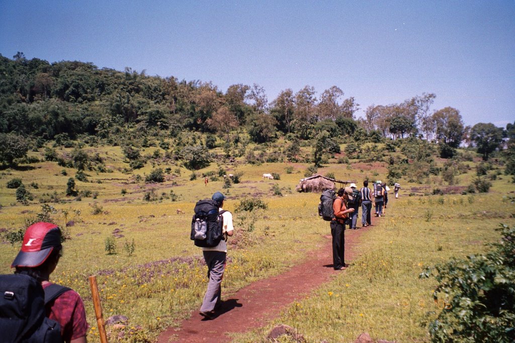
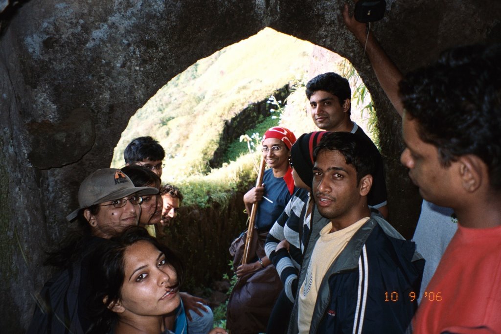
2) To enter the fort via Gunjavane Darwaja you take the Pune-Velha bus to Margasani Village and from there you go via Sakhargaon to Gunjavane village. From here, it is a two hour climb to the Gunajvane Darwaja. This is the route we took, though we needed more than 3 hours to reach the Padmavati machee.
3) The easiest route is from Vazeghar or from Pali and then to the Pali Darwaja. This takes about 3 hours to reach the top.
4) Another favourite route is through the Chor Darwaja. To reach here you take the Velhe bus to Vinzar village, cross the Kanandi River and climb up via Sakhargaon. This takes about 4 hours trek, the last part of this path being quite rocky. This is the route we took for our return.
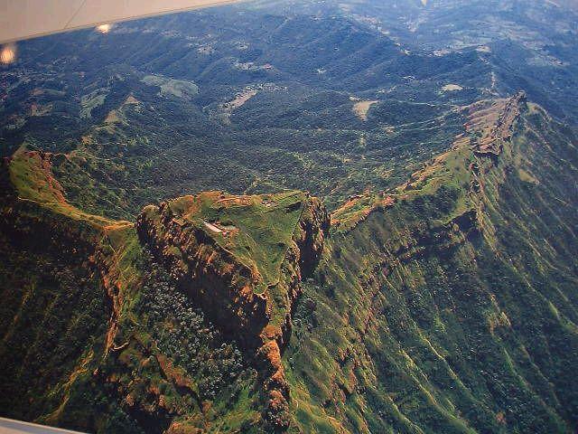
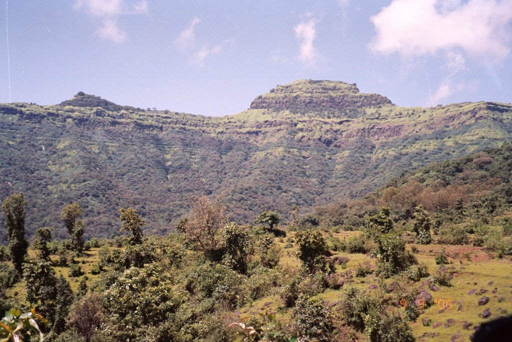
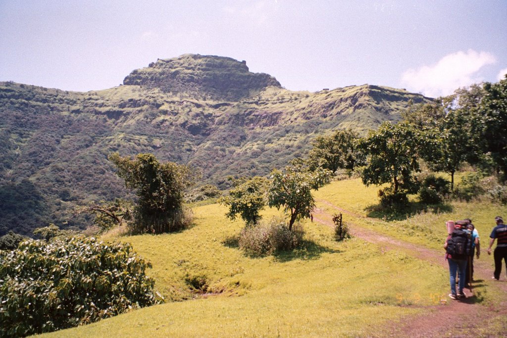
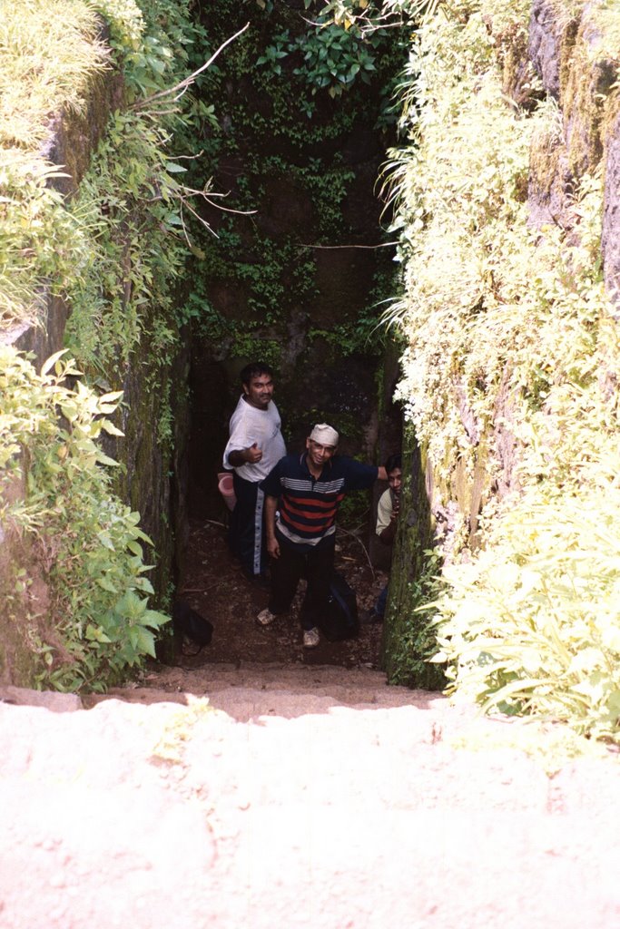
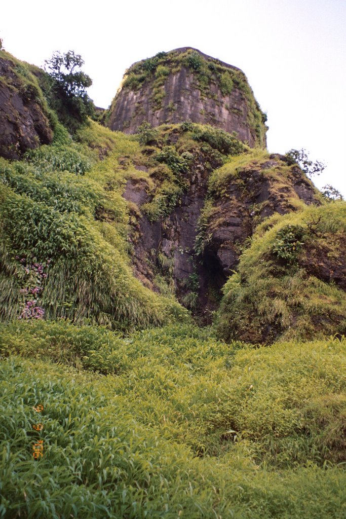
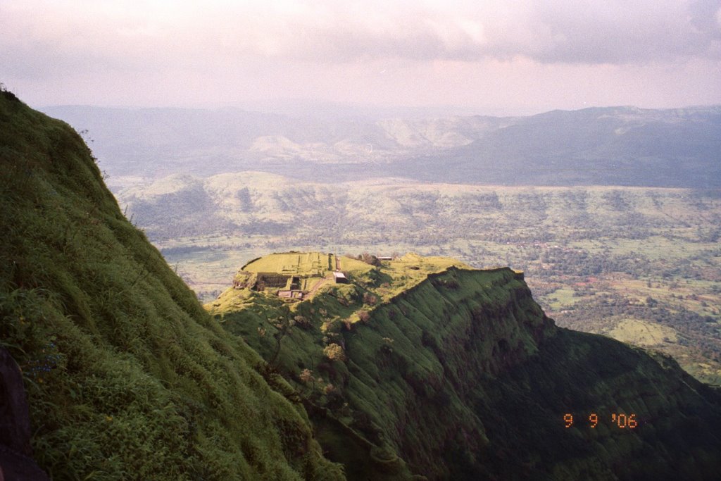
The fort is located at the end of spur, surrounded on three sides by fortified ridges – the Padmavati Machee, the Sanjivani Machee, and the Suvela Machee. The Padmavati Machee is the largest of the three, perhaps this was where most people stayed at that time. Three main darwaja of the fort that open onto Padmavati Machee: the Chor darwaja, the Pali Darwaja and the Gunjawane Darwaja.
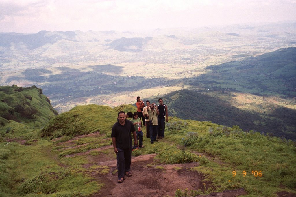
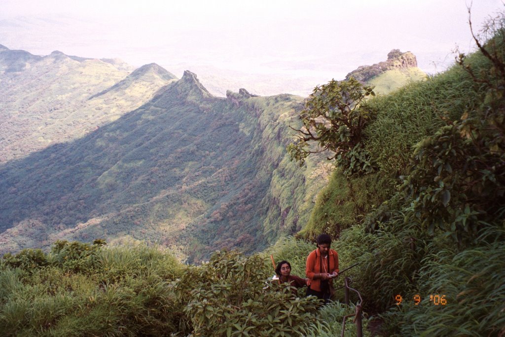
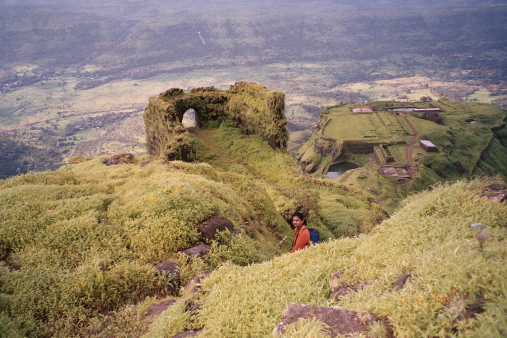
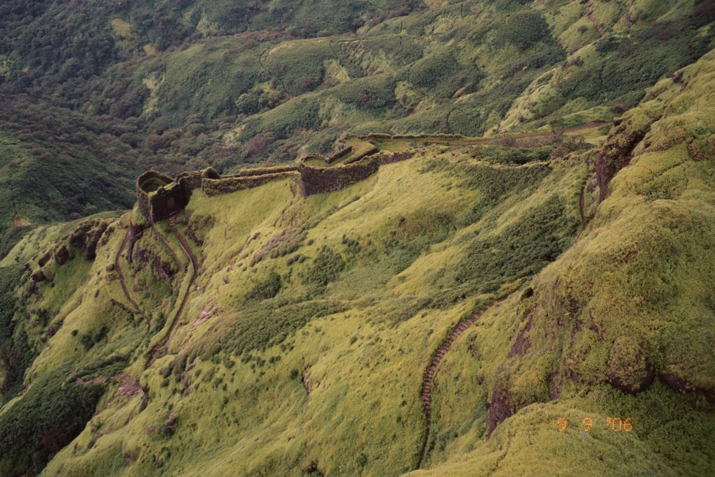
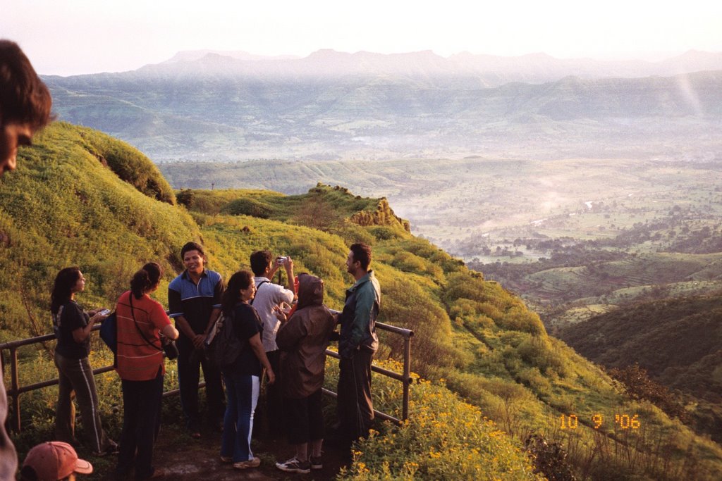
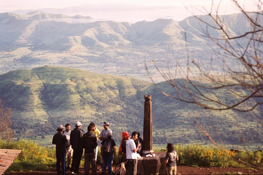
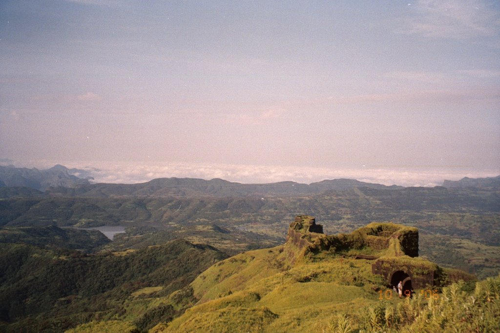
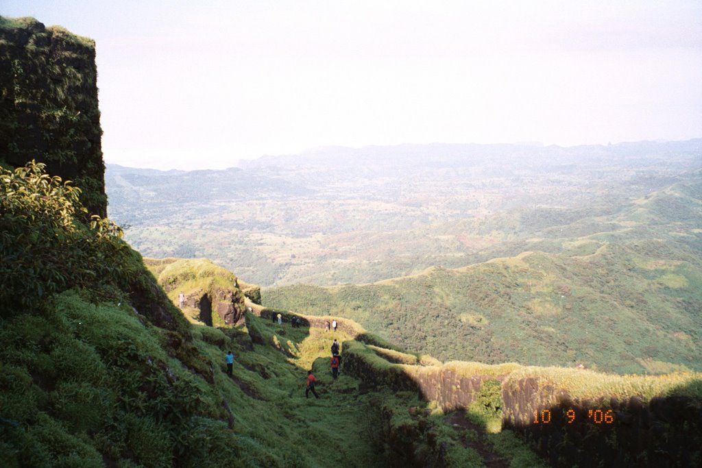
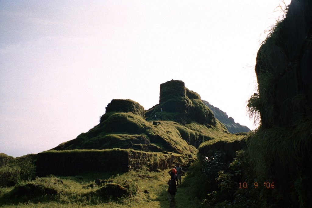
The ruins of the Padmavati temple, the Padmavati lake, the Maharaja residential palace, the havaldar’s wada (constable’s residence) can all be seen here. The only place which can be used by trekkers for an overnight stay here is the Padmavati temple. Of the three Plains, the narrowest is the Suvela Machee. Stone steps, ramparts and a bastion can be seen here. On this plain is a 15 foot-diameter opening called Waghacha Doda (tiger’s eye). Several of Shivaji’s officers including Tanaji, Yesaji and Shembar Built houses here. The view of the sunrise from this point is really beautiful. The third plain, Sanjivani machee is about two Kilometer in length. Double fortification and a bastion can be seen here. There is a direct route from this point, through the Alu Darwaja, to the Budhala Machee on Torna. The stronghold of Rajgad is said to be its finest point and can be reached with some effort. Once you enter the main gate you can see the palace ruins, the Janani Mandir and the Bramhrisi temple and a water tank. There is quite wonderful view from the top, you can see various mountain ranges and spot several forts from here including the Mahabaleshwar Raireshwar Plateau, Raigad, Makarandgad, Lingana, Torna, Visapur, Tung, Sinhgad and Purandar.
Rajagad is built on a hill named Murambdev which was not captured for a long time. In 1702 Aurangzeb laid siege on Rajgad and changed its name to Najibgad. Around Rajgad are the rivers Velwandi, Kanadi and Gujavani, so that all routes to the routes to the fort are across rivers. The main gates to the fort are Alu Darwaja, Gunjavane Darwaja, Pali Darwaja and Chor Darwaja.
Reaching Rajgad
1) To enter the fort via Alu Darwaja. From Pune, proceed to Bhor. Near Bhor, board a launch at Basrapur at the Bhatgar dam. A five-hour ride will take you to Bhutonde, which is at the foothill of Rajgad. From Bhor you can also take a bus for village Bhutonde. From Bhutonde, it is a three hour climb to the Alu Darwaja.
2) To enter the fort via Gunjavane Darwaja you take the Pune-Velha bus to Margasani Village and from there you go via Sakhargaon to Gunjavane village. From here, it is a two hour climb to the Gunajvane Darwaja. This is the route we took, though we needed more than 3 hours to reach the Padmavati machee.
3) The easiest route is from Vazeghar or from Pali and then to the Pali Darwaja. This takes about 3 hours to reach the top.
4) Another favourite route is through the Chor Darwaja. To reach here you take the Velhe bus to Vinzar village, cross the Kanandi River and climb up via Sakhargaon. This takes about 4 hours trek, the last part of this path being quite rocky. This is the route we took for our return.
The fort is located at the end of spur, surrounded on three sides by fortified ridges – the Padmavati Machee, the Sanjivani Machee, and the Suvela Machee. The Padmavati Machee is the largest of the three, perhaps this was where most people stayed at that time. Three main darwaja of the fort that open onto Padmavati Machee: the Chor darwaja, the Pali Darwaja and the Gunjawane Darwaja.
The ruins of the Padmavati temple, the Padmavati lake, the Maharaja residential palace, the havaldar’s wada (constable’s residence) can all be seen here. The only place which can be used by trekkers for an overnight stay here is the Padmavati temple. Of the three Plains, the narrowest is the Suvela Machee. Stone steps, ramparts and a bastion can be seen here. On this plain is a 15 foot-diameter opening called Waghacha Doda (tiger’s eye). Several of Shivaji’s officers including Tanaji, Yesaji and Shembar Built houses here. The view of the sunrise from this point is really beautiful. The third plain, Sanjivani machee is about two Kilometer in length. Double fortification and a bastion can be seen here. There is a direct route from this point, through the Alu Darwaja, to the Budhala Machee on Torna. The stronghold of Rajgad is said to be its finest point and can be reached with some effort. Once you enter the main gate you can see the palace ruins, the Janani Mandir and the Bramhrisi temple and a water tank. There is quite wonderful view from the top, you can see various mountain ranges and spot several forts from here including the Mahabaleshwar Raireshwar Plateau, Raigad, Makarandgad, Lingana, Torna, Visapur, Tung, Sinhgad and Purandar.
Rajagad is built on a hill named Murambdev which was not captured for a long time. In 1702 Aurangzeb laid siege on Rajgad and changed its name to Najibgad. Around Rajgad are the rivers Velwandi, Kanadi and Gujavani, so that all routes to the routes to the fort are across rivers. The main gates to the fort are Alu Darwaja, Gunjavane Darwaja, Pali Darwaja and Chor Darwaja.
Labels: Rajgad
posted by Unny @ 12:17 AM
0 comments
![]()
![]()